Archaeologists examine mysterious Roman road cutting across southern Golan Heights
Lack of links to Jewish towns indicates Roman-Jewish tensions

An ancient Roman road cutting across Israel's southern Golan Heights was recently analyzed by Israeli and European archaeologists. The road was allegedly built during the latter half of the 2nd century A.D. and abandoned in the early 4th century A.D.
Archaeologists and scholars, Dr. Adam Pažout from Aarhus University, together with Dr. Michael Eisenberg and Dr. Mechael Osband from Haifa University and the Zinman Institute, meticulously examined the fascinating find in a recent comprehensive study.
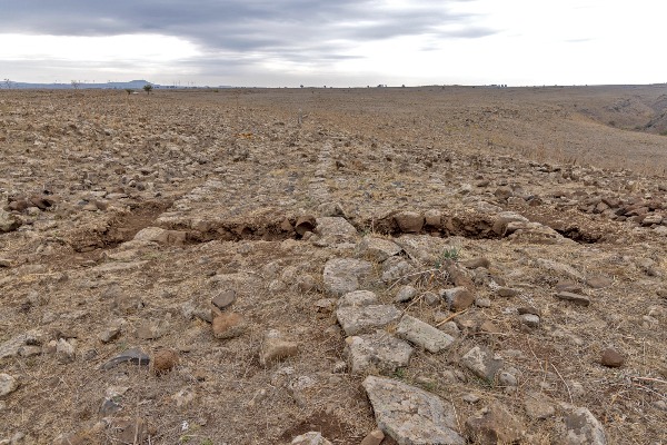
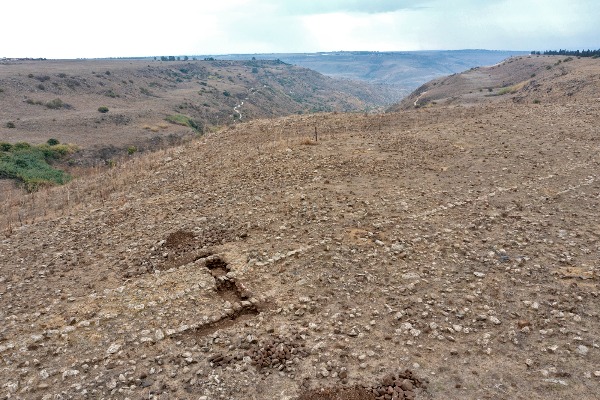
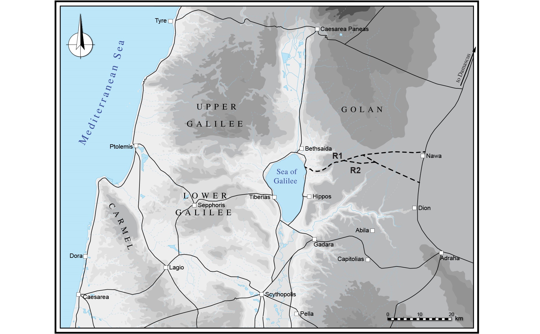
A little less than 2,000 years ago, Roman soldiers and skilled engineers built a two-lane highway traversing the southern expanse of the Golan Heights, spanning from the shores of the Sea of Galilee in modern-day Israel to the ancient city of Nawa in Syria. Notably, where the 39km (24 miles) road crossed flood-prone streambeds, it was elevated on embankments, showcasing the Romans' ingenuity in engineering.

This particular road stands as just one testament to the vast network of thoroughfares the Roman engineers constructed throughout their empire, including the Holy Land (called Judea before 132-4 A.D. and the province of "Syria Palaestina" after). Several roads are located specifically in the "Gaulanitis" region, the modern Golan Heights, however, what sets this roadway apart is the intriguing question of its purpose and significance within the regional context.
The Golan, a basaltic plateau framed by the Yarmouk River in the south, the Sea of Galilee and Hula Valley in the west, the Anti-Lebanon Mountain range with Mount Hermon in the north, and the Wadi Raqqad river valley in the east, occupies a significant portion of the border region between modern Syria, Lebanon, and Israel. Following the 1967 Six-Day War, Israel took control of two-thirds of the area previously owned by Syria, subsequently annexing it in 1981.
Since 1967, Israeli archaeologists, in collaboration with scholars from around the world, have conducted extensive geological, archaeological and relief research to document the area. Among the finds are the enigmatic Rujm el-Hiri monument and various other sites, including a significant number of Jewish villages and synagogues from mainly the Roman, but also the Byzantine period. One of them is Um-El-Kanatir, an ancient Byzantine Jewish village that has lost its original name. The 1,500-year-old beautiful synagogue there has been completely rebuilt using precise scientific methods.
Through a meticulous analysis of the road's construction timeline, its proposed objectives, and interaction with settlements along its route, researchers have gleaned valuable insights into the motivations behind its creation. Published in the biannual journal of the Tel Aviv University Institute of Archaeology, the findings of this study shed light on the complex interplay between Roman infrastructure and regional dynamics.

The historical backdrop against which this road emerged dates back to the conquests of Alexander the Great in 332 B.C. and the beginning of Hellenistic presence and influence in the area, followed by a succession of Hellenistic rulers and empires vying for control over the region. When Rome began its involvement in the area, the Hasmonean Jewish Dynasty had witnessed a tumultuous series of power struggles, culminating in the Roman intervention in 63 B.C. under Pompey the Great, which marked the onset of Roman hegemony.
Since Pompey's conquest, the Jewish Hasmonean power weakened considerably, giving freedom back to the Greek "poleis" cities and generally changing the area tremendously. Herod the Great, a vassal king to Rome, began building infrastructure according to Roman standards. The Roman prefects and procurators who replaced him, and after the two Jewish revolts of 70 A.D. and 132-134 A.D., the Roman army, built many Roman roads, aqueducts, and infrastructure known in the Holy Land today.
Indeed, the development of a vast network of roads was integral to Roman governance, facilitating communication, trade and military maneuvers across the empire. The newly uncovered route in the southern Golan Heights exemplifies the Roman engineering prowess and was adorned with watchtowers strategically positioned at intervals of approximately every Roman mile, alongside milestones inscribed with dates and imperial reigns.
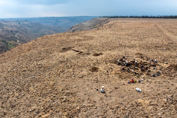
Divided into two distinct sections, the road presents a nuanced picture of Roman construction techniques and temporal variations in its development. Excavations at key sites along the route, such as the watchtower at el-Qusaybe, have unearthed a treasure trove of artifacts, providing valuable clues to the road's usage and eventual abandonment.

What emerges from this multifaceted analysis is a portrait of Roman strategic planning and administrative foresight. While the road apparently did not directly intersect with local Jewish settlements, its significance transcends a specific dynamic between Jews and Romans during that time.
The road's lack of connection to major Jewish villages or towns in the southern Golan Heights highlights the tension between the Roman administration and local Jews. This suggests the road was likely used for military rather than commercial goals. Relations had already been strained due to two major Jewish revolts, which caused significant destruction. Tensions further intensified during the Byzantine era, with the Christian Byzantine persecution of the Jewish community.
During the late Roman and early Byzantine periods, the primary Jewish community in the Holy Land was located in the eastern Galilee and the Golan Heights.
In the paper, the authors wrote: "The direct involvement of the Roman army in policing and surveillance in the interior of the province suggests serious security concerns, felt in a predominantly Jewish area (Gaulanitis) even several generations after provincialisation of the region."
The road's construction, likely initiated in the 60s of the 2nd century A.D., speaks to Rome's long-term vision for the region, encompassing not only military logistics but also land allocation and colonization efforts among a mainly Jewish territory. The division of land along the roadway into rectangular fields further underscores Rome's meticulous approach to territorial governance and resource management.
Moreover, the road's eventual abandonment in the early 4th century A.D. coincides with broader shifts in the Roman Empire's military organization and geopolitical landscape. As internal strife and external pressures mounted, the need for extensive military infrastructure waned, leading to the decommissioning of watchtowers and the gradual obsolescence of the road network.

This study delves into the intricate interplay between the sole urban center of the vicinity, Hippos-Sussita, the Roman army and the Jewish hinterland, shedding new light on the dynamics of Roman provincial administration.
As excavations continue and new discoveries come to light, our understanding of ancient Israel continues to evolve, offering fresh perspectives on the enduring legacy of Roman civilization in the southern Golan Heights and beyond, throughout the Holy Land and the Mediterranean basin.

The All Israel News Staff is a team of journalists in Israel.
You might also like to read this:


